
Find Valparaiso Neighbors by Block
Define the area before looking for Valparaiso neighbors. A touching parcel, a lot across the street, a whole block, and a neighborhood association are four different boundaries. Public sources can map parcels, name owners of record, confirm a specific voter with the required facts, or identify a civic group. None creates a complete list of everyone living nearby.
| Source | What It Shows About a Block | Access |
|---|---|---|
| Porter County GIS | Touching lots, roads, buildings, parcel numbers, and boundaries | Free map and REST services |
| XSoft and tax list | Owner of record, situs, mailing clue, legal description, and tax context | Free public portals |
| Recorder and plats | Transfers and original lot or subdivision relationships | Free index, paid images, office books |
| Voter records | Individual confirmation or a regulated precinct-list request | IndianaVoters and county office |
| City Neighborhood Hub | Neighborhood profile and organization contact | Public, opt-in civic route |
| Historical directories | Dated households along a block | Library and archive collections |
The property roll proves who is listed for tax or title purposes. It does not prove current occupancy. A company, estate, trust, or distant mailing address may appear as owner. Renters and other household members may not appear at all. Record the source date and describe the result as ownership evidence unless another official source supports more.
Choose the source to match the question. GIS answers which lots touch. XSoft answers whose name appears on the parcel card. A deed answers how title moved. The Hub answers which civic profile covers an address. Historical directories answer who was listed at a location in one published year. Keeping those answers separate prevents a block map from turning into an unsupported resident roster.
Set a Valparaiso Neighbor Boundary
For the most precise neighbor search, begin with parcels that share a boundary with the subject lot. Add across-the-street parcels only after marking the road or right-of-way. A same-block search follows frontage between cross streets. Association geography is broader and may not match a subdivision, ZIP code, precinct, or city limit.
Save the subject parcel ID, adjacent parcel IDs, map date, and legal descriptions. Combined lots can share one parcel number, and some mapped parcels have no attached data. Those are reasons to contact GIS or the Assessor, not to guess. A current city profile can classify a neighborhood, while the tax district and legal description control the county-record route.
Across-the-street parcels require special care because a wide right-of-way, alley, corner, or offset frontage changes what “across” means. Use the road and building layers, then inspect each parcel independently. A buffer is useful for a reproducible radius, but a large circle can pull in several blocks and unrelated subdivisions. Record the distance used so another person can repeat the result.
Map a Valparaiso Neighbor Block
The Porter County general map service confirms municipality, township, roads, buildings, parcels, sections, lot annotations, and condominium names. Zoom until parcel lines appear, then use Identify on the subject lot. Select or Buffer can highlight nearby parcels and owners within a chosen distance. Keep the radius modest so the result remains a block study.
- Locate the address or parcel and note its number, municipality, road, and building outline.
- Click each touching and across-street parcel. Save the parcel number and legal description separately.
- Open each result in XSoft or the tax list. Compare owner, situs, mailing clue, and any deduction evidence without claiming occupancy.
- Print or save the parcel list with the map date. Use the full Valparaiso street directory method only when the question expands beyond the block.
The Porter County general GIS layer service exposes the confirmed map layers behind this method.
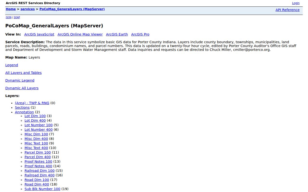
The layer inventory shows why parcel and road geometry can define nearby lots while still saying nothing certain about occupancy.
The tax parcel service supports narrow identify and query controls, but a full county request can exceed the visible record limit. Work from the subject parcel outward. Turn on only confirmed layers, including municipality, township, roads, buildings, sections, parcels, and condominium names. Zoning, flood, school, and voting layers were not confirmed in the inspected services, so do not infer them from a general map color.
Check Valparaiso Neighbor Ownership
Open every mapped parcel in the Porter County assessor search. Note owner name, property address, mailing address if displayed, parcel number, class, legal description, sale history, and linked card. A homestead deduction can be an owner-occupancy clue, but it is not a guarantee that the person is present now.
Use the Recorder only when the ownership link needs more proof. Direct Search reaches early 1978 and supplies index data without images. Tapestry includes images for a current county-listed $8.75 search. A plat may explain why a driveway, shared line, condominium, or combined parcel looks odd on the map. For missing attributes, call the Assessor or GIS before moving to a broader request.
Mailing and situs fields deserve separate notes. The situs address locates the land. The mailing field points to where tax material goes and may belong to an owner elsewhere. Sale history and a homestead deduction add context, but neither names every household member. When a parcel is held by a trust, estate, or company, the deed may identify a signer while still not proving who resides there.
Note: Parcel owners are not automatically your Valparaiso neighbors in the everyday sense, so label every owner-only result clearly.
Valparaiso Voter Records Stay Narrow
IndianaVoters confirms a specific registration when the user supplies first name, last name, date of birth, and Porter County. It is not a public browse tool for everyone on a block. Precinct and split-precinct modes help identify election geography, but do not disclose a neighbor roster.
An existing precinct or voter-list report may be requested from Porter County Elections & Voter Registration under Indiana rules. State guidance distinguishes restricted and unrestricted files, redacts sensitive fields, and protects Address Confidentiality Program participants. The annual unrestricted file is priced at $5,000, while ordinary individual confirmation has much narrower fields. State the precinct, date, and format when asking what public report already exists.
The county elections office can explain whether an existing public precinct report fits the request. Indiana agencies do not have to create a new custom compilation. Date of birth, full Social Security number, phone, gender, voting history, and other fields face limits. Indiana also does not register voters by party in the way some states do, so a registration result should never be labeled as party membership.
Do not work around a protected result. A blank or limited address can reflect a lawful safety restriction.
Valparaiso Neighborhood Hub Changed
The city announced a new interactive Neighborhood Hub in August 2026 with address search, profiles, and 54 neighborhoods. A November 2025 workshop document listed 52 named groups. The count difference is a date marker, not an error to smooth over. Use the newer Hub for classification and the dated workshop list as a snapshot of organizations active in that event.
The Valparaiso Community Engagement page leads to the Hub, toolkit, grants, workshops, and civic contacts.
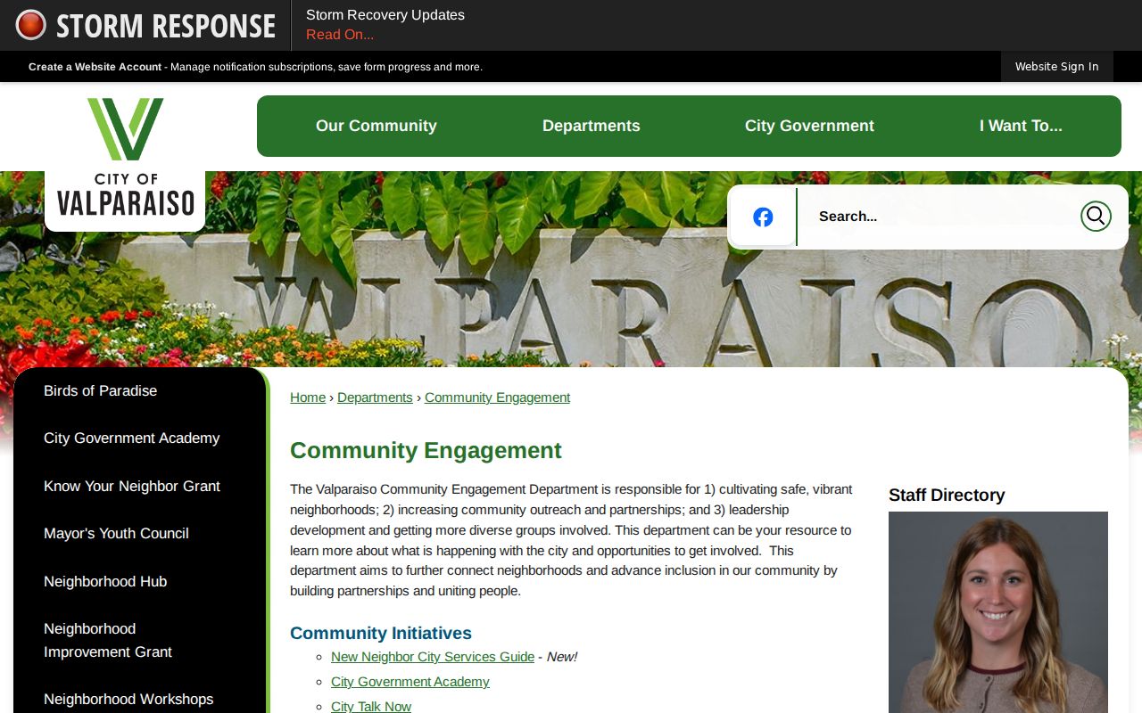
The city resource connects a street to a public organization profile. It does not publish private member or resident rosters.
The dated workshop list spans neighborhood associations, condominium groups, HOAs, and POAs. Those labels describe different forms of organization. They also may cover only part of a subdivision or may change over time. Confirm the current contact through the city route. A missing profile does not mean the homes lack neighbors, and a named association does not mean every nearby resident is a member.
Contact Valparaiso Civic Neighbors
Community groups offer a voluntary way to meet neighbors without extracting private data. Use a city or published group contact and ask about an open meeting, workshop, cleanup, or event. Do not request a complete member list. The workshop inventory includes Banta, Central, College Hill, Bicentennial Square, Campbell Martin Street Neighbors, and many HOA or POA groups.
Community Engagement
Neighborhood toolkit, Hub, directory work, grants, and city contact routes.
Neighborhood Workshops
Public workshops and representative RSVP route through Maggie Clifton, 219-462-1161.
Know Your Neighbor
An open-event grant offers $250 yearly, or up to $500 for a new group, with advance application.
Neighborhood Improvement Grants also reveal active organizations. In March 2026, Valparaiso announced 14 grants totaling $106,256. Since 2018, the city reports 139 projects in 45 neighborhoods and more than $1.9 million citywide. Those figures show civic activity, not membership.
Examples among the 2026 grantees include Beauty Creek Villas, Bridgewater Estates, College Hill, Hawthorne, Jefferson Park, Keystone Commons, Manchester Meadows, Meridian Woods, Pepper Creek Estates, and Timberbridge. A grant announcement can verify that a group acted publicly at that date. It cannot supply the names of all owners, officers, or residents unless the announcement itself publishes an authorized contact.
Official Valparaiso Neighbor Evidence
Official sources are slower to combine, but each has a known custodian and a defined purpose. Commercial neighbor tools merge data from many dates and may hide source age or matching errors. Use them, if at all, only as unverified leads and never as substitutes for a parcel, deed, voter confirmation, or opt-in civic contact.
| Source type | Strength | Main limit |
|---|---|---|
| County GIS and assessor | Dated parcel geography and owner of record | Does not prove occupancy |
| Recorder and plat | Recorded transfer and lot relationship | Owner history, not household roster |
| City Hub and civic groups | Current public organization contact | No private membership list |
| Commercial compilation | Broad lead collection | Unknown freshness, matching, and source context |
If an online map fails, call GIS or the Assessor. For existing permit, tax, deed, or precinct records, submit a focused Indiana public-records request. PCPLS directories and newspapers add the historic block layer.
A focused request names the address, parcel, date range, and existing record class. Ask for a permit file, tax record, plat, or precinct report instead of asking an office to build a list of people. Specify electronic or paper format and accept required redactions. This approach is easier for the custodian to process and less likely to sweep in data unrelated to the block question.
Historic Valparaiso Neighbors
City directory street pages can reconstruct a dated block, including renters and businesses that ownership rolls omit. Selected Valparaiso runs begin with 1885 to 1886 and continue through early local editions, twentieth-century Polk volumes, and 2012 or 2015 reference copies. Search both the address section and alphabetical names.
Sanborn maps show buildings and lot context, not resident identity. Pair them with a directory and a publicly released census. The 1893 to 1902 street-numbering change can break a literal match, so preserve cross streets, adjacent households, and the old number. An obituary or deed can then explain why a named household left the block.
The Larry J. Clark Genealogy Center holds directories, yearbooks, microfilm, indexes, and newspaper resources. Ask for a street or reverse page near the target year. Then search alphabetical entries for each possible household. Occupations, spouse notes, and boarding marks help separate same-name people. Since directory publication was periodic, always state the year rather than describing the result as continuous residence.
Protect Privacy of Valparaiso Neighbors
Parcel, deed, and tax systems publish limited government records. They do not open utility, delivery, school, private association, or complete household data. Indiana's Address Confidentiality Program gives eligible victims a substitute service address, and participant voter details are confidential. Certain covered people can also seek restrictions in public property contexts under IC 36-1-8.5.
Do not use a second portal to defeat a protected flag. If a record is wrong, ask the custodian for a correction or the proper statutory restriction route. Indiana's private-data law, effective in 2026 for covered controllers, does not create a blanket erasure right for county records that law makes public.
Accuracy also protects privacy. Check the parcel number and map date before connecting a name to a lot. Distinguish a mailing address from a situs address. Do not infer family ties from shared surnames, or current presence from an old directory. When a source conflicts with another, keep both dates and ask the custodian which record is authoritative for its own purpose.
Contact should remain voluntary. The city Hub, an open workshop, or a public neighborhood event offers a better introduction than private-data collection. If a safety concern involves an immediate threat, use the proper public-safety channel rather than building a private file about the block. Ordinary neighbor curiosity does not justify seeking restricted voter data, private association rosters, utility accounts, or protected addresses.
Recheck time-sensitive results. GIS parcels can change after a split or combination, assessor data updates on its cycle, civic contacts rotate, and a directory profile may be revised. Save the date of every result. A dated, narrow finding is more useful than a broad claim that every person on a Valparaiso block has been identified.
Lawful use. Use a Valparaiso neighbor search for civic curiosity, an opt-in introduction, reconnection, or personal safety awareness. Never watch, harass, intimidate, or harm anyone.